ROMEO5 Ground
Flight Information Display
and Situational Awareness
for ATC and AFIS


Enhanced situational awareness
Romeo5 Ground enables the ATCO to have a greater knowledge of the ground activity. This can assist with workload reduction, and the reduction of RWY incursions.

Safe and cost-effective
Once running, the FID requires very little service/maintenance. For units where a FID may be a future replacement to traditional radar systems, this can provide large cost savings in ongoing costs of maintaining such equipment.

Cloud and on-premise
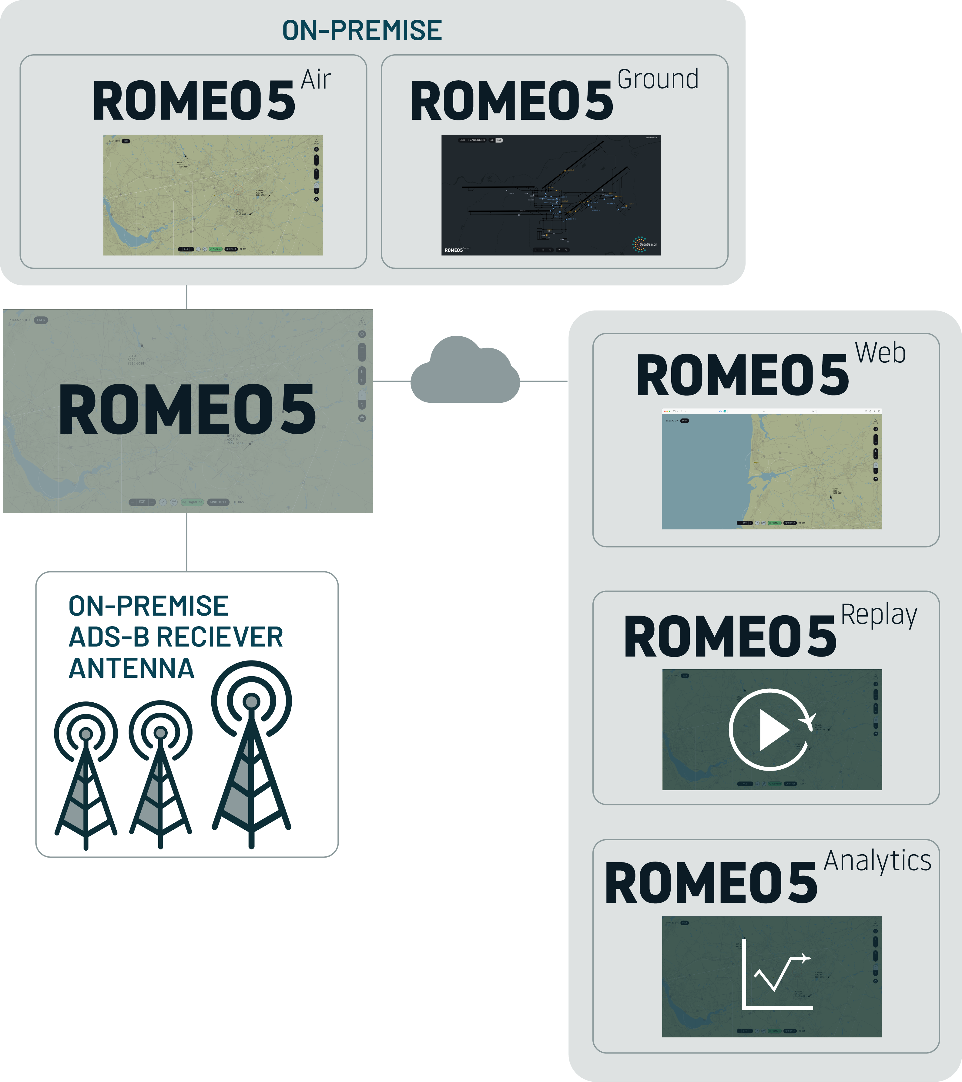
Flexible deployment as a local and cloud-based web application, ensuring uninterrupted operations and robust backup in any scenario. Both cloud and on-premise, simultaneously or alternatively, Romeo5 Ground ensures uninterrupted access to critical data.

Customisable and user-friendly
The user-friendly and intuitive system with customisable features allow Romeo5 Ground to be tailored to meet the specific needs of the service provider. Mapping, target and label display options and user defaults can be customised.

Recording and Playback
Romeo5 Ground allows 30 day record/playback and export of all video recordings, meaning it can easily deployed where required to assist with incident investigation.

Real-time Data
Romeo5’s ability to process vast amounts of real-time data ensures efficient handling of all air traffic and data demands with ease. Position data of aircraft or vehicles ‘target’ positions is updated approximately every second.

ADS-B data resilience
Romeo5 maximises accuracy and reliability by merging data from multiple ADS-B antennas (if needed, many times just 1 antenna on top of the TWR provides excellent coverage). Users can switch between local or cloud data sources and visually track which ones are in use.

Ease of installation
Romeo5 GND is designed for easy setup. Its FID comes pre-configured, ready to deploy with minimal antenna installation required. DataBeacon assists with final configuration. Additional items like screens, keyboards, and cables are not included, allowing users to choose what suits their needs and budget.
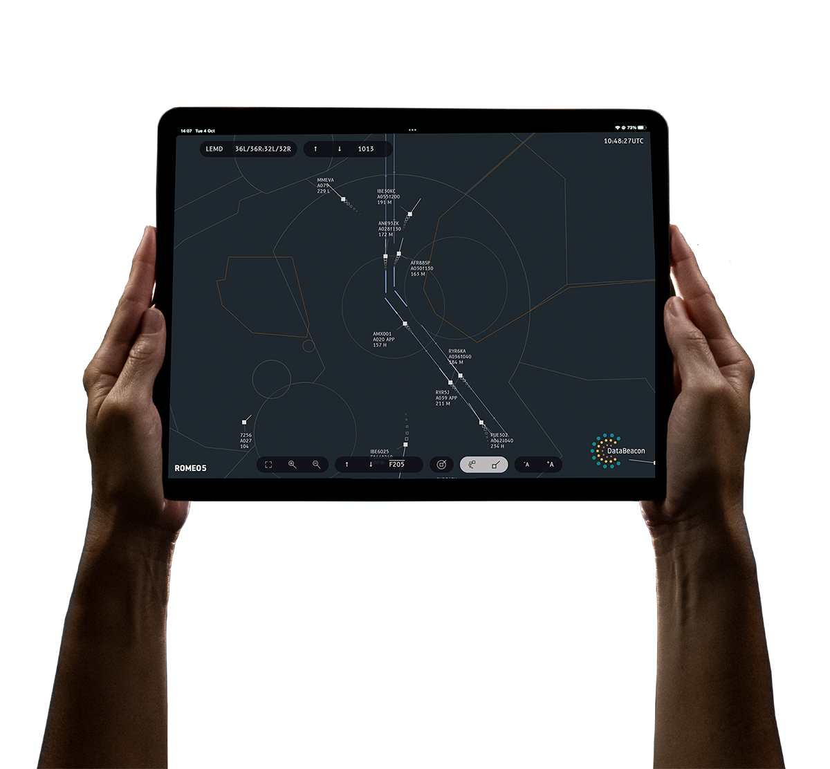
Romeo5 Ground is an advanced, ATM-grade Flight Information Display (FID) system that delivers real-time aircraft position data within an airport’s movement area (runways, taxiways, and aprons). This capability enhances situational awareness for
Air Traffic Control Officers (ATCOs), proving particularly valuable during Low Visibility Operations (LVO).
It includes the most relevant ALERTS such as runway occupancy, runway closed, collision alert when an aircraft takes off or lands on an occupied runway by ground vehicles, excessive taxiway speed, and more. Besides, it is adapted to manually list non-cooperative traffic (usually ground vehicles with no ADS-B equipment).
Designed to align with emerging regulatory standards,
Romeo5 Ground complies with Europe’s forthcoming SMAS requirements—where DataBeacon has been a key contributor—
as well as the FAA’s SAI regulations in the United States.
Data is received from ADS-B, with one or more antennas deployed as needed to ensure optimal coverage. Signals are merged to enhance accuracy. Additionally, browser based access to the FID allows for monitoring and information retrieval away from operational positions.
The FID runs on a single, pre-configured standalone small form factor PC, which can be connected to a monitor of your choice. Multiple FID units can be provided for redundancy.
ROMEO5 Ground is also offered with optional cloud-based data feeds, ensuring multiple layers of redundancy and enhanced data validation for the FID. Further information is available on request.

Targets and Labels
Romeo5 Ground accurately positions aircraft on the airport map and generates labels containing the callsign or registration. It differentiates arrivals, departures, and ground vehicles. For departures, the label includes the aircraft’s wake turbulence category, as provided by ADS-B, to support vortex separation for consecutive departures. Additionally, it identifies traffic squawking emergency codes.
To prevent overlap, labels are automatically positioned using an intelligent label avoidance algorithm. To further enhance situational awareness, Romeo5 Ground includes a speed vector indicating the aircraft’s projected position in 30 seconds.
Control Elements
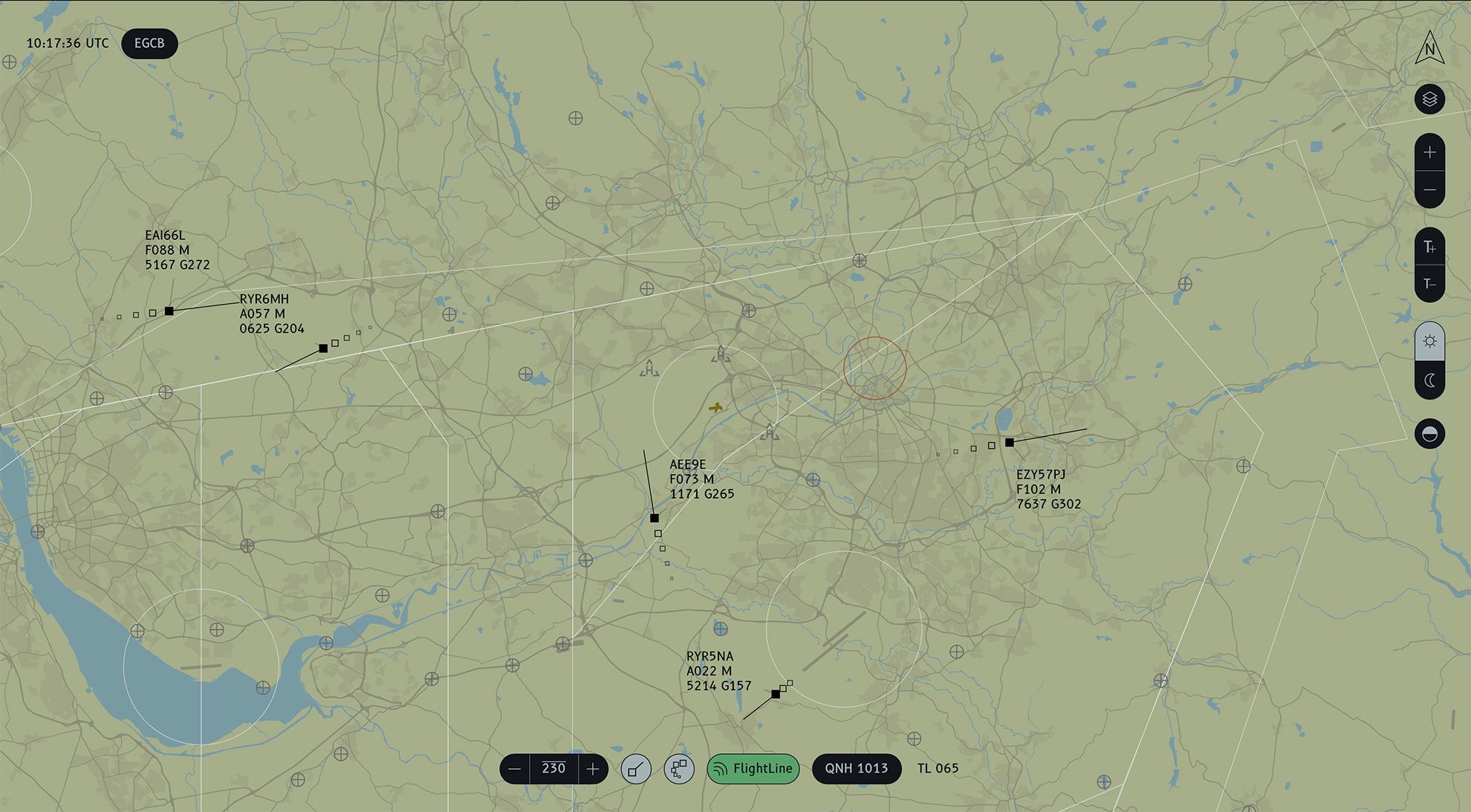
The system incorporates a range of intuitive control elements, aligning with best practices in the industry, SMAS and SAI regulations. Users have the capability to zoom the map and labels independently, providing a customisable display that caters to specific operational requirements.
The system also prioritises contrast for optimal visibility, ensuring that displayed information remains clear and discernible in various ambient lighting conditions. In instances where multiple antennas and/or cloud are deployed, the system allows for seamless antenna selection, providing flexibility and control over the data sources used for enhanced precision.
Lists
Romeo5 Ground includes listing functionalities to integrate non-equipped vehicles into the operational picture. Additionally, it automatically lists the callsigns of all equipped ground vehicles upon entering any runway.
Safety nets
Romeo5 Ground includes relevant alerts, such as runway occupancy, ground vehicles entering into the runway, excessive speed on the taxiway, collision alert when aircraft are taking off or landing on a runway occupied by ground vehicles, etc. The deployment level is customisable based on client requirements.
Maps and Layers
The mapping functionality within Romeo5 Ground is designed to align with the stringent standards, ensuring accuracy and compliance in displaying critical flight information. During the design phase, we offer a high degree of customisation, empowering them to tailor the map orientation to either the North or align it with the perspective as seen from the tower window. This adaptability caters to individual preferences, providing a client- centric interface for enhanced operational efficiency.
Moreover, during design, the system offers comprehensive customisation options, enabling clients to personalise maps by incorporating essential details such as gates, names on the TWYs, stand numbers, relevant buildings, etc.
Romeo5 Ground further enhances its versatility with the integration of customisable layers. Users can selectively activate or deactivate layers to display different elements, such as Low Visibility Procedures. This layering capability ensures that the displayed information is contextually relevant and aligns precisely with the operational needs of the users.
Pricing
Delivery Schedule
We provide an estimated schedule to deliver the system within 8 weeks, which includes all elements of customization, internal testing, acceptance testing, shipping, and necessary mapping customizations to ensure the system is fully functional upon delivery. Our design process ensures that the final system is first deployed on a web environment for approval, simplifying feedback from our customers and ensuring
deadlines are met.
FAQs:
Romeo5 has been designed specifically for use by ATC and AFIS to enhance situational awareness. It provides reliability and accuracy of information displayed. The display is designed to be user focussed, with clear non overlapping labels and adjustable day/night and brightness levels. Romeo5 displays data received from dedicated receiver(s), ensuring full integrity of data and also includes QNH Altitude/Level conversion.
Romeo5 is able to receive any transmitted ADS-B data via a number of available receivers. Such ADS-B may be received from aircraft, ground vehicles and UAVs. In certain antenna configurations it is also able to receive and display FLARM data.
In the UK and the USA it is also compatible with uAvionix Managed Airspace Surveillance Service providing additional data integrity, enhanced coverage and redundancy.
The FID allows the user to select the actively used data sources and provides clear indication of the active status of each source.
Romeo5 has been designed to meet or exceed the requirements within CAA CAP670 requirements, and is declared as compliant by DataBeacon.
Romeo5 is designed and tailored for the specific requirements of the airport. Local mapping with airspace and other required layers is included and configured during the initial setup, with future updates included.
Each target can display Callsign/Registration, Altitude/Level, Speed, Heading, Squawk, Type Code. History Trailers and predict vector lines are also available.
Yes, Romeo5 offers the flexibility to be run both locally and in a cloud environment as a native web application, providing a robust backup or mobile contingency system. This local setup ensures uninterrupted operations and immediate access to critical data even in the event of internet connectivity issues or other external disruptions.
All data is retained for a period of 30 days, allowing playback and export of any period. Optionally, we offer a data cloud-based replay tool with unlimited storage capability.
Romeo5 has been designed to be a cost-effective alternative to expensive radar systems. Romeo5 runs on a simple dedicated hardware device and requires only simple antenna installation to become operational. The system, once running requires very little to no ongoing engineering input. This enables Romeo 5 to be adaptable to suit all scale of service provider.
From commencement of an agreement, we are able to complete all customisation, prepare, test and deliver Romeo5 to you within a timescale of 6-8 weeks.
Throughout the contract period, Romeo5 is supported by the dedicated DataBeacon support team, who will provide comprehensive hardware/software and user support as required. All change requests to mapping are included.
